Introduction
This prospectus was commissioned by Islington Council‘s Local Economies Team and is funded by the UK Government through the UK Shared Prosperity Fund. The document has been created by Office S&M Architects with support from Jamila Saha and additional community engagement carried out by Holloway Neighbourhood Group. A microsite, created by Adam Tarasewicz, has been developed to go with this document.
History of Nag's Head
Future
Site allocations, tall buildings and council policies
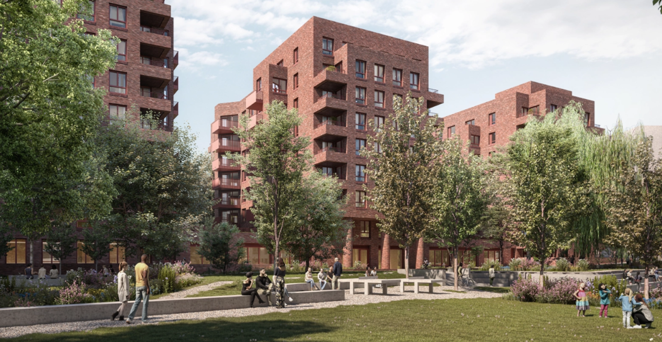
The future of Nag’s Head Town Centre will bolster existing retail uses, build more homes and create spaces for employment opportunities. In the next 15 years, the Islington Local Plan expects 1,530 homes and 22,000 sqm of office space to be delivered in the town centre.
Key Development Sites
As part of the Local Plan, a series of site allocations have been identified. A key development site is the Morrison's supermarket and its car park. It has been identified for mixed-use development, including residential, retail and office space with Nag’s Head Covered Market being retained and enhanced. This site, along with 5 others in the Nag’s Head area, have been highlighted by the Islington Tall Buildings Study as potential sites for buildings above 30 meters. Another key site just outside the Nag’s Head Town Centre is the redevelopment of Holloway Prison. This is a residential-led development with community uses including a Women’s Building and open space.
In addition to the Local Plan's site allocations, planning applications are being considered for other sites including Marlborough Building and 356 Holloway Road. The London Metropolitan University also intend to improve its Holloway Road campus, making it more welcoming for community events and visible in the streetscape. Alongside this are projects funded by the Community Infrastructure Levy (CIL) and Secton 106 (S106) ensuring developments support community needs and improvements. You can find more information on Islington Council's Interactive Map.
Sustainability and Climate Action Initiatives
Islington Council is working on several initiatives to improve the lives of residents in and around the town centre. An example of this is the Annette Road Liveable Neighbourhood initiative which combines improvements to local streets, greening and low-traffic measures to reduce road danger and create greener and healthier spaces. This initiative also links up with Transport For London (TfL) cycle route C50, connecting Finsbury Park, Nag’s Head and York Way. Islington Council is working in partnership with London Metropolitan University and the Emirates Stadium to promote the proposal for an Arsenal Net Zero Neighbourhood. This would see the building of a district heating network supplying low carbon heating to homes and local businesses, improving energy efficiency, and installing solar panels and electric vehicle charging points.

Engagement
We understand the importance of listening to and making local voices heard as local peopleare experts on the local area. As part of Nag’sHead Prospectus of Ideas, we set out to find what local businesses, residents and visitors think of the town centre and what would make it better for all, now and in the future.
What are the challenges that Nag's Head Town Centre is facing?
Being at the crossroads of Holloway Road (the A1) and Seven Sisters Road (A503), Nag’s Head Town Centre suffers from heavy road traffic that separates the area. This has created a disconnected and low sense of place among businesses, visitors and local people.
With few open or green spaces and dominant road traffic, there is little space for walking, wheeling and other public uses in the town centre. A general lack of pleasant spaces for people to dwell, limited public facilities like toilets and a low sense of safety due to challenges with crime and anti-social behaviour, tend to make many visits to Nag’s Head Town Centre brief. With retail at its heart and few free activities, spending time often means spending money in shops or on services.
Nag’s Head Town Centre is the meeting point of five Islington ward boundaries, meaning there is no single political oversight. With Holloway Road and Seven Sisters Road being red routes, Transport for London (TfL) manages and maintains the roads and their public pavements. This means the council has little control over the development of these roads. As Islington Council do not own any of the town centre’s commercial properties this makes it difficult to unlock spaces for alternative and meanwhile uses.
The town centre also faces economic challenges with business rates and rents being high and many of the local people not having much disposable income. Despite being bustling during the day, it also lacks a strong evening economy making it inactive at night which contributes to the low sense of safety.
Key Challenges
Environmental
- Lack of green spaces and inviting public realm in the town centre
- Dominant road traffic with little space for pedestrians on Holloway Road and Seven Sister’s Road
- Difficulties in unlocking spaces for alternative and meanwhile use
Social
- Low sense of place in the community
- Lack of social spaces and public amenities for people to dwell
- Low sense of safety when using the town centre during all hours of the day
Economic
- Poor connections between businesses, community and cultural organisations
- Lack of an evening economy activating the town centre at night
- Lack of free activities available to people with low disposable income


A clear vision for Nag's Head
The foundation of this vision and the catalogue of ideas lies in the wealth of initiatives and projects already happening in the Nag’s Head area. The aim with this vision is build onto and celebrate these initiatives while at the same time outline new ideas that together with the the existing opportunities envision the future of Nag’s Head.
Create stepping stones for local businesses to growth and testing new ideas and celebrates Nag’s Head as a small business hub. It also identifies opportunities for young people in the area both through creative and trade paths.
The vision outlines opportunities for improvements from a social, economic and environmental view point.
It aims to enhance the current daytime economy and programming while at the same time identify opportunities for the evening or night time economy to grow. This will help activate the town centre throughout all hours of the day.
Through the catalogue of ideas presented in this chapter we show examples of how future improvements can be made in Nag’s Head that respond to the aspirations and needs of local people and stakeholders.
Funding streams
There is a range of resources and other organisations available to help access funding streams for future projects, both from council funds and charities. The list below identifies some key funding streams and resources that can support the future delivery of the prospectus.
Section 106
Section 106 (S106) agreements are legal agreements between developers and local authorities as part of the planning process. They secure funding or contributions from developers to offset the impact of new developments. The funding can be used for affordable housing, schools, parks, transport improvements, and other community infrastructure.
The Community Infrastructure Levy (CIL)
The Community Infrastructure Levy (CIL) is a funding source from new developments to help local authorities improve a range of infrastructure. CIL funding can be used to secure planning obligations, such as financial contributions for affordable housing, carbon offset measures, affordable workspaces, and transport network improvements.


